

Create Geolocation using JavaScript
Creating geolocation functionality using JavaScript involves using the browser's Geolocation API to retrieve the user's current location. Here's an example of how you can create geolocation functionality:
1. Set up your HTML structure:
<!DOCTYPE html>
<html>
<head>
<title>Geolocation Example</title>
<link rel="stylesheet" href="styles.css">
</head>
<body>
<div class="geolocation">
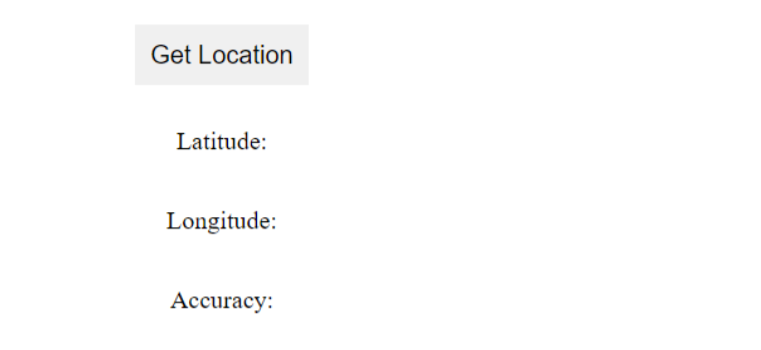
<button id="getLocation">Get Location</button>
<p id="latitude">Latitude: </p>
<p id="longitude">Longitude: </p>
<p id="accuracy">Accuracy: </p>
</div>
<script src="script.js"></script>
</body>
</html>2. Create a CSS file (styles.css) to style the geolocation display:
css
.geolocation {
  display: flex;
  flex-direction: column;
  align-items: center;
}

.geolocation button {
  margin-bottom: 10px;
  padding: 10px;
  font-size: 16px;
  background-color: #f0f0f0;
  border: none;
  cursor: pointer;
}
3. Now, create a JavaScript file (script.js) to handle the geolocation functionality:
javascript
  document.addEventListener('DOMContentLoaded', function () {
    const getLocationButton = document.getElementById('getLocation');
    const latitudeElement = document.getElementById('latitude');
    const longitudeElement = document.getElementById('longitude');
    const accuracyElement = document.getElementById('accuracy');

    function showPosition(position) {
      const latitude = position.coords.latitude;
      const longitude = position.coords.longitude;
      const accuracy = position.coords.accuracy;
      latitudeElement.textContent = `Latitude: ${latitude}`;
      longitudeElement.textContent = `Longitude: ${longitude}`;
      accuracyElement.textContent = `Accuracy: ${accuracy} meters`;
    }

    function handleLocationError(error) {
      let errorMessage = 'Error: ';

      switch (error.code) {
        case error.PERMISSION_DENIED:
        errorMessage += 'User denied the request for geolocation.';
        break;
        case error.POSITION_UNAVAILABLE:
        errorMessage += 'Location information is unavailable.';
        break;
        case error.TIMEOUT:
        errorMessage += 'The request to get user location timed out.';
        break;
        case error.UNKNOWN_ERROR:
        errorMessage += 'An unknown error occurred.';
        break;
      }

      latitudeElement.textContent = errorMessage;
      longitudeElement.textContent = '';
      accuracyElement.textContent = '';
    }

    getLocationButton.addEventListener('click', function () {
      if (navigator.geolocation) {
        navigator.geolocation.getCurrentPosition(showPosition, handleLocationError);
      } else {
        latitudeElement.textContent = 'Geolocation is not supported by this browser.';
      }
  });
});
4. Place all the files (HTML, CSS, and JS) in the same folder.
Open the HTML file in a web browser, and you should see a "Get Location" button. Clicking the button will prompt the user to allow access to their location. If granted, the latitude, longitude, and accuracy of the user's current location will be displayed on the webpage. If there is an error retrieving the location, an error message will be displayed.
Output:
About the Author

Silan Software is one of the India's leading provider of offline & online training for Java, Python, AI (Machine Learning, Deep Learning), Data Science, Software Development & many more emerging Technologies.
We provide Academic Training || Industrial Training || Corporate Training || Internship || Java || Python || AI using Python || Data Science etc


PreviousNext
Join our newsletter for the latest updates.
About us
Our Services
Contact Us
Our Courses
Learn Python | Learn AI | Learn Machine Learning | Learn Deep Learning | Learn Core Java | Learn Java JSP | Learn Java Servlet | Learn Java Spring Core | Learn Spring Boot | Learn Power BI | Learn DAA | Learn HTML | Learn SQL | Learn C Programming | Learn Bootstrap | Learn Git | Learn JavaScript | Learn Data Structure Using C | Learn RDBMS | Learn Data Science | Learn PHP
Our Tutorials
Python Tutorial | AI Tutorial | Machine Learning Tutorial | Deep Learning Tutorial | Core Java Tutorial | Java JSP Tutorial | Java Servlet Tutorial | Java Spring Tutorial | Spring Boot Tutorial | Power BI Tutorial | DAA Tutorial | HTML Tutorial | SQL Tutorial | C Programming Tutorial | Bootstrap Tutorial | Git Tutorial | JavaScript Tutorial | Data Structure Using C Tutorial | RDBMS Tutorial | Data Science Tutorial | PHP Tutorial
Copyright © 2023 Pythontpoint Powered by Silan Software Pvt. Ltd. All rights reserved.